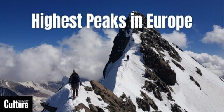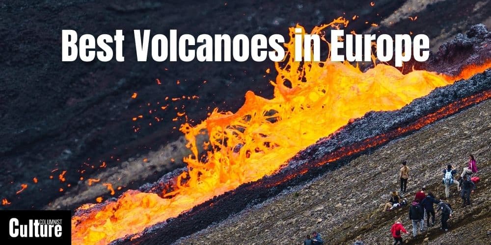
Top 10 Volcanoes To Visit In Europe
Europe’s volcanic landscapes offer a unique blend of natural beauty, geological wonder, and historical intrigue, making them a must-visit for adventurers and nature lovers alike.
From the fiery craters of Italy to the mystical peaks of Iceland, the European continent boasts some of the most fascinating volcanoes in the world.
In this article, I’ll take you on a journey to explore the best volcanoes to visit in Europe, each with its own story to tell and wonders to see.
From Mount Etna, Italy’s towering giant and the highest active volcano in Europe, renowned for its frequent eruptions to the geothermal pools and springs of Furnas in the Azores, this guide explores everything you need to know to find the best volcanic adventure for your trip.
Through this article, readers will learn not only about the geological marvels and historical eruptions of these volcanoes but also about safety considerations, the best times to visit, and the unique experiences each volcano offers.
Whether it’s hiking up to craters, witnessing the glow of lava, or exploring the surrounding landscapes, these volcanic destinations promise unforgettable adventures.
Mount Etna, Italy
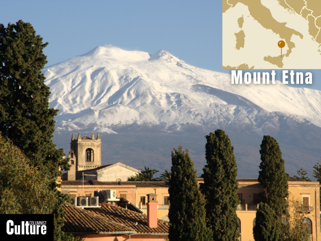
Mount Etna is located on the east coast of Sicily, Italy. It is the highest active volcano in Europe, standing at 3,357 meters (11,013 feet) and one of the most active volcanoes in the world. Mount Etna is a UNESCO world heritage site due to its scientific and cultural significance.
Mount Etna has 4 main craters and 300 lateral craters and emits lava and smoke. Etna has been active for about 500,000 years, and eruptions happen multiple times in a year. The first recorded eruption was in 1500 B.C., and since then, Etna has erupted at least 190 times. The last significant eruption of Mount Etna was in February 2021.
Etna is considered safe; it is monitored constantly, and most eruptions are small. It can be visited year-round but is best climbed in April–September, with no need for mountaineering equipment. It’s possible to hike certain areas on your own, but climbing to the summit is only possible with a guide and depends on the weather conditions and volcanic activity.
Vesuvius, Italy
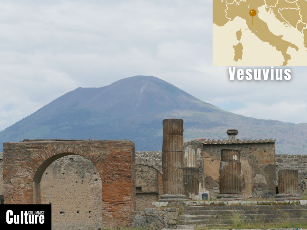
Mount Vesuvius is located on the Gulf of Naples in Italy. Vesuvius is 1,281 meters (4,200 feet). It has had two eruptions that rank among the largest in Europe’s history. Nicknamed the ‘Sleeping Giant’ Vesuvius is known for its destruction of the ancient city of Pompeii in 79 AD. Mount Vesuvius is a UNESCO world heritage site and has brought global fame to the region of Campania.
Mount Vesuvius has a high, semicircular ridge called Mount Somma. At the cone’s summit is a large crater that was formed in the 1944 eruption. Vesuvius is 200 thousand years old; it first erupted 25,000 years ago and has since had 54 confirmed eruptions. Experts believe that it is overdue for an eruption. Its last eruption was in 1944.
Vesuvius is safe to visit. It is under constant surveillance, and visits to the volcano will be prohibited if considered dangerous. You can visit the volcano alone; however, this requires the use of public transportation or a private vehicle. Climbing Mount Vesuvius is relatively easy but gets slightly more difficult the higher you ascend.
Stromboli, Italy
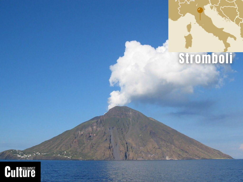
Stromboli is located in the Tyrrhenian Sea, off the north coast of Sicily. It is one of the world’s most active volcanoes, with eruptions so intense that the term ‘Strombolian’ is used to describe eruptions at other volcanoes. The volcano rises 924 meters above sea level, forming one of the seven Aeolian Islands that have been awarded UNESCO status.
Stromboli has three active craters at its peak. It has small and sometimes large eruptions of red-hot lava and smoke. The first eruptions date to about 200,000 years ago, which began to form the volcanic island. Small eruptions from Stromboli occur nearly every 20 minutes, and the last serious eruption occurred in 2009.
Stromboli is typically safe to visit year-round, provided there are no dangerous activity warnings. You can take a boat tour or a guided excursion from Stromboli town. The main trail is unpaved and is approximately 9 km (6 miles) with a strenuous incline. Alternatively, you can hike alone to the Sciara del Fuoco viewpoint, a red stream of lava that flows into the sea.
Tholos Naftilos, Greece
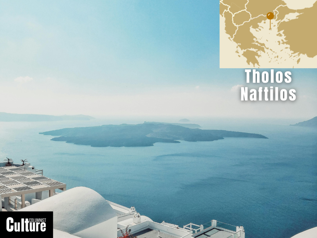
Tholos Naftilos is located in the South Aegean, Greece. The volcano lies between the Thirassia and Santorini islands. It is the location of the historic Minoan Eruption that occurred around 1500 BC, which devastated the island of Thera (Santorini), including the ancient Minoan civilization that lived there.
The volcano’s craters are located on the two small islands, Palea Kameni and Nea Kameni. It is thought to be over 500,000 years old, and although it has been dormant since its last eruption in the 1950s, it is still considered active. There have been 12 major eruptions in its history, and while it doesn’t erupt frequently today, there are still craters and vents that emit fumes and vapours.
Tholos Naftilos is considered safe to visit; this is partly because the very active part of the volcano lies underwater. Visitors can take a boat trip and hike around the lava fields of Palea and Nea Kameni alone or with a tour guide. If you’re adventurous, you can scuba dive on Adiavatous Reef, located inside the rim of the caldera near the volcano.
Mount Teide, Spain
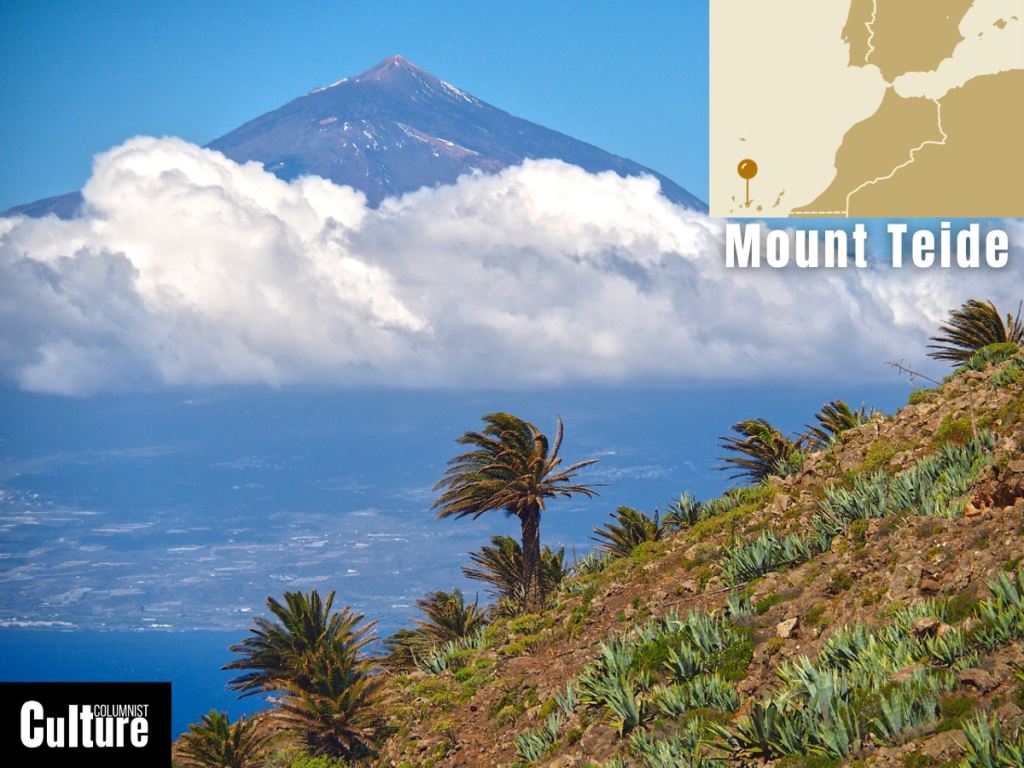
Mount Teide is located on the island of Tenerife. It is the third-largest volcanic structure in the world and the highest peak in the Canary Islands and Spain. Mount Teide rises to 3,715 meters (12,188 feet) and is the main feature of Teide National Park, a UNESCO World Heritage Site.
The volcano has a distinctive cone shape and a circular crater about 80 metres (260 feet) in diameter. It is roughly 170,000 years old and erupts 1-2 times every 100 years. The first recorded eruption happened in 1704 and 1705, and it has erupted around 13 times since that period, with its last major eruption in 1909.
Mount Teide is closely monitored and is safe to visit, though it is an active volcano. It is best to visit the site with an experienced tour guide. You can reach the volcano’s upper station with the Teide cable car, but climbing to the summit is only possible with a permit from the National Park, which regulates visitor numbers to protect the environment.
Öræfajökull, Iceland
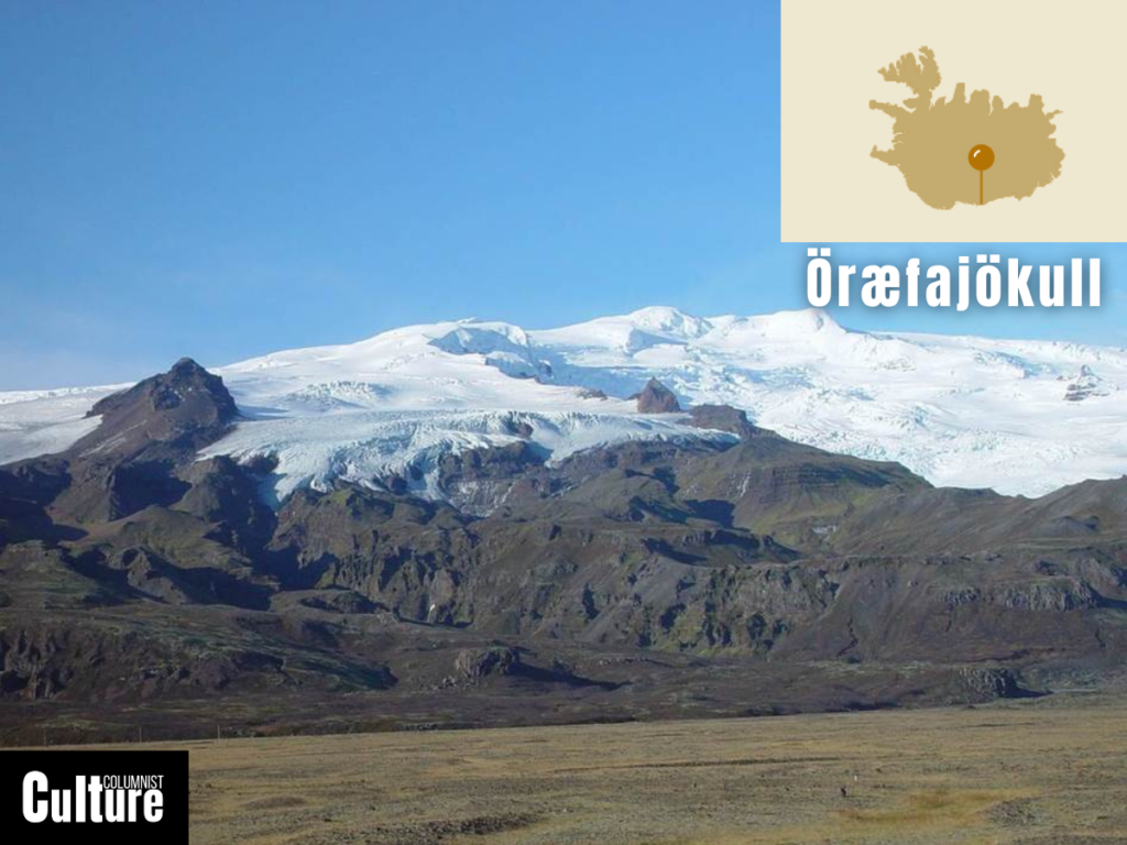
Öræfajökull is located in Iceland and is the second-largest volcano in Europe. Its highest peak is Hvannadals Peak on the north-west rim is 2,119 meters (6,952 feet) above sea level and is also the highest peak in Iceland. The volcano lies under the Vatnajökull glacier, the largest glacier in Europe.
Öræfajökull’s ellipse-shaped crater is 5km (3 miles) wide with a rim that is around 1,850 meters (6,068 feet) in height. The deepest layers of the volcano are 781,000 years old but its exact age is not known. There are two records of the volcano erupting, the first in 1362 and the second in 1727.
The volcano is safe to visit. Experts are uncertain about when it will erupt but it is under constant surveillance. It is possible to climb to the peak of the volcano but it is for experienced climbers only. Öræfajökull is located within Vatnajökull National Park, with plenty of other ways to explore Iceland’s Volcanic Way including snowmobile tours, super jeep tours and ski tours.
Eyjafjallajökull, Iceland
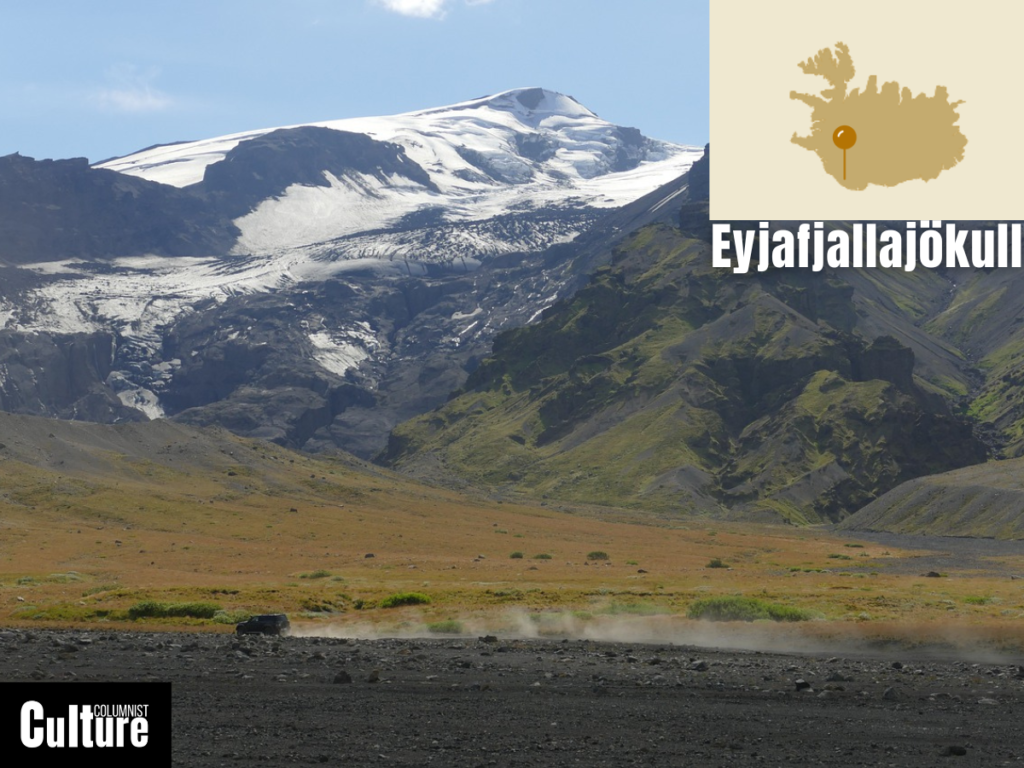
Eyjafjallajökull volcano is a subglacial volcano located in southern Iceland within the country’s volcanic zone. The volcano rests beneath Eyjafjallajökull (Eyjafjalla Glacier). It rises to a height of 5,466 feet (1,666 meters) above sea level. It is best known for disrupting air traffic in 2010 after an eruption shot vast plumes of smoke and ash into the air.
Eyjafjallajökull has an enormous snow-capped crater about 3–4 kilometers (1.9–2.5 miles) wide. The volcano doesn’t erupt frequently; there are only 3 records of it erupting. The first recorded eruption was in 900 AD, with subsequent eruptions in 1612 and from 1821–1823.
Eyjafjallajökull is safe to visit; it is not expected to erupt for another few hundred years, and the volcano is also closely monitored to detect any dangerous volcanic activity. You can climb Eyjafjallajökull’s summit, Hamundur, with a tour guide, explore the surrounding area by super jeep tour, or just view the volcano from Iceland’s Ring Road if you prefer to keep your distance.
Pico do Fogo, Cape Verde
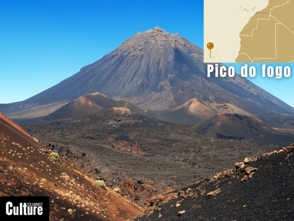
Pico do Fogo is the highest peak of Cape Verde, an archipelago located off the coast of West Africa but politically a part of Europe. Situated on Fogo Island, the volcano features a prominent caldera, which is a large, bowl-shaped crater approximately 9 km (5.6miles) wide formed by the collapse of land following an massive eruption.
The formation of Pico do Fogo is thought to have started 4.5 million years ago. The first recorded eruption occurred in 1680 AD. Since people started to settle on the island in the 15th century, the volcano has erupted more than 30 times, with the last significant eruptions being in November 2014 and February 2015.
It is generally safe to visit and even climb the Pico do Fogo year round. However, it can be closed on short notice if conditions change. Guides are mandatory if you want to climb to the summit, and they can usually take you to the crater rim at 2,770 meters (9,087 feet).
Hekla, Iceland
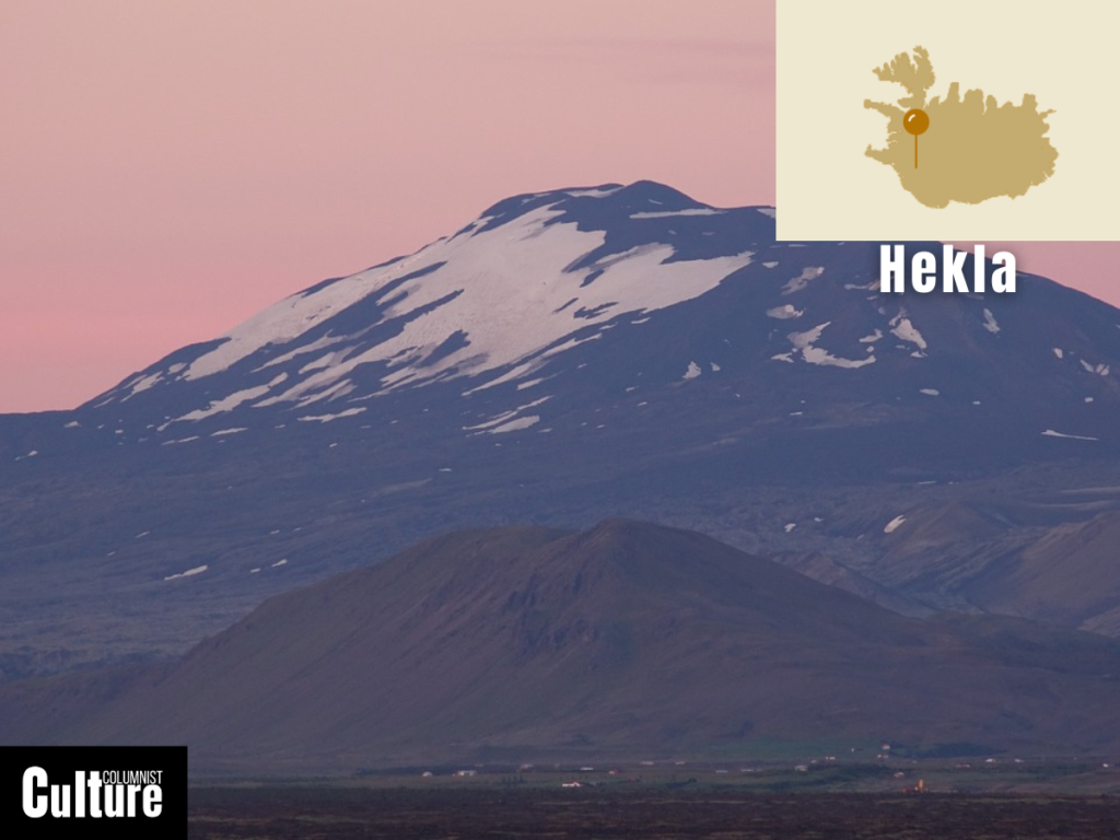
Hekla is one of Iceland’s most famous and active volcanoes, located in the southern part of the country, approximately 110 kilometers east of Reykjavik. Often referred to as the “Gateway to Hell” in medieval European literature, Hekla has had frequent eruptions throughout history, the first recorded one being in 1104.
Hekla is considered a young volcano, having formed 6,000–7,000 years ago. It is considered an active volcano and its last eruption happened in February 2000. It’s generally considered safe to visit, but tours or access to the region can be closed unexpectedly if there is any dangerous activity expected.
Climbing Hekla is possible, but it is always done with an experienced guide and is mostly for fairly experienced mountaineers. In spring, you can ski around the crater, or in summer, you can hike to Hekla’s summit, which is 1,491 meters high and takes around 3–4 hours to complete.
Furnas, Azores
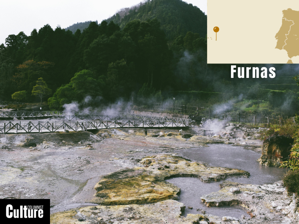
Furnas Volcano is located on the Azores island of São Miguel in the North Atlantic Ocean. Furnas is the easternmost of the three central volcanoes on the island. The volcano crater, also known as the Furnas Valley, is known for its geothermal activity, natural hot springs, thermal pools, and vents that emit steam and volcanic gases.
Furnas emerged about 300,000 years ago and is considered dormant. The volcano has two recorded eruptions in its history—1441 and 1630—and is generally considered safe to visit. One of its unique features is the Furnas Lake, which sits within the caldera and contains naturally carbonated mineral water due to volcanic gases.
While there is no central peak to climb, there are other ways to explore the volcanic area with lagoon trails, volcanic cave excursions, shore excursions, and walking guides around the island’s Geopark. The Azores Global Geopark comprises nine islands in the archipelago with 16 major volcanoes and has been a UNESCO World Heritage Site since 2013.
Why does Europe have so many volcanoes?
Europe has so many volcanoes because of its position on Earth, where tectonic plates meet and move. This movement can cause the Earth’s crust to crack or push together, creating conditions for volcanoes to form. Areas like Iceland and Italy are particularly volcanic because of these plate movements and hot spots beneath the Earth’s surface.
Why are there no volcanoes in the Alps?
The Alps do not have volcanoes because they do not lie on a tectonic plate boundary. Most volcanoes form at the boundaries of Earth’s tectonic plates because one plate moves beneath the other, allowing magma to rise to the surface and form volcanoes.
So, while the Alps are the result of massive tectonic forces, they do not have the conditions necessary for ongoing volcanic activity. Instead, the Alps of Europe are known for their impressive peaks and ranges, which were formed by the slow collision of the Eurasian and African tectonic plates but they don’t lie on the boundary between them.
What country has the most volcanoes in Europe?
Iceland is the country with the most volcanoes in Europe. There are approximately 130 active and inactive volcanoes on the island, of which around 32 are considered active. Italy is the only country in mainland Europe with active volcanoes. Out of 12 volcanoes in Italy, 9 are still considered active.
What volcanic country has hot springs and geysers in Europe?
Iceland is the most volcanic country in Europe, known for its hot springs and geysers. The geothermal activity is due to the island’s location on the Mid-Atlantic Ridge, where the North American and Eurasian tectonic plates meet, leading to high volcanic activity, which in turn heats underground water to form hot springs and geysers.
Italy also has hot springs and geysers, particularly in areas like Tuscany. These geothermal features are due to Italy’s volcanic activity and its location, where the African and Eurasian plates meet. Other countries with volcanic geothermal activity include Bulgaria, Greece and the Azores, which have some of the most famous hot springs and thermal pools in Europe.