Best Mountain Ranges To Explore In Europe
Europe is a continent rich in majestic mountain ranges, each offering its own unique allure. From the snow-capped Alps to the rugged terrain of the Pyrenees, the options for mountain-based adventures are virtually limitless.
Deciding which mountain range to explore can be a daunting task. Are you drawn to the winter sports potential of the Alps, or are you more interested in the hiking and cultural experiences found in ranges like the Carpathians or the Apennines?
The best mountain range for you depends on what types of outdoor activities you enjoy, the level of challenge you’re looking for, and the specific geographic and climatic features that interest you. Accessibility is also an important factor to consider, with some ranges well-served by public transportation and others more remote and challenging to navigate.
Whether you’re a solo adventurer, planning a romantic getaway, a family trip, or looking for easily accessible ranges for older travelers, there’s a mountain range in Europe that is waiting to be explored. Below is a list of the most captivating mountain ranges in Europe, designed to guide you to the mountain range that will make your European adventure unforgettable.
The Alps
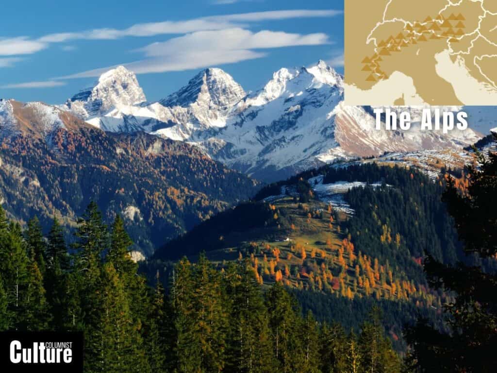
The Alps are a prominent mountain range located in Central and Southern Europe, spanning across eight countries: France, Switzerland, Monaco, Italy, Liechtenstein, Austria, Germany, and Slovenia. The Alps are the highest and largest mountain range in Europe, with the French and Swiss Alps being two of the top skiing destinations in the world.
The Alps stretch approximately 1,200 kilometers (750 miles) from east to west. The highest peak is Mont Blanc, which has an elevation of 4,808 meters (15,774 feet). The range hold’s Europe’s largest glacier, the Aletsch Glacier of Switzerland, and other famous glacier’s like the Rhone and La Mer de Glace.
Alpine towns like Davos, Halstatt, and Salzburg offer insights into the unique architecture and history of the different cultures that have inhabited the range for centuries, including Romansh in Switzerland and the Tyrolean culture, which dominates parts of the Austrian Alps.
The range is packed with things to do in both summer and winter, from historical sites like medieval castles to UNESCO World Heritage Sites like the Abbey of Saint John and the Abbey of Saint Gall. The range is home to Europe’s largest ski resort, Portes du Soleil, with over 650 km, and the famous Tour du Mont Blanc hiking route, a classic trek around the Mont Blanc massif.
The Carpathians
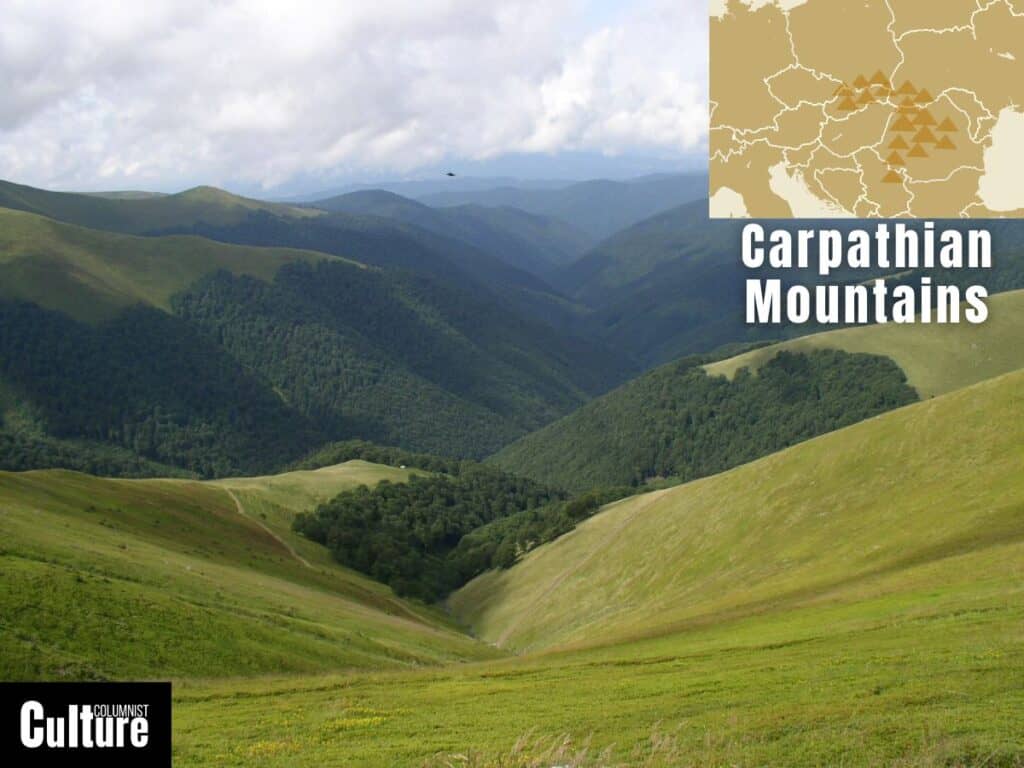
The Carpathians mountain range is located in Central and Eastern Europe and is spread across seven countries: Czech Republic, Slovakia, Poland, Hungary, Ukraine, Romania, and Serbia. The range forms a wide, crescent-shaped arc that makes its way from the Danube Gap, near Bratislava, Slovakia, to the Iron Gate gorge in Romania. It has some of Europe’s largest populations of brown bears, wolves, Eurasian lynxes and golden eagles.
The Carpathians span approximately 1,500 kilometers in length and 500 kilometers at their widest. The highest peak of the range is the Gerlachovský štít in Slovakia, reaching an elevation of 2,655 meters (8,711 feet). The mountains harbor more than 200 km2 (20’000 hectares) of primeval forests, the Jaskinia Wielka Śnieżna (“great snowy cave”) in Małołczniak, and the Djerdap gorge, the dramatic gateway of the Danube.
Eastern European towns like Brașov, Zakopane, and Prešov are notable for their distinctive architecture and wooden churches. Thermal towns like Băile Tușnad, Borsec and Piešťany provide visitors with the opportunity to sample the benefits of the naturally-occurring highly-mineralised waters by bathing in the town’s therapeutic hot springs and thermal pools.
The Carpathians are home to historical landmarks such as the Bran Castle, often linked with the legend of Dracula, and UNESCO World Heritage Sites like the Wooden Tserkvas of the region. Zakopane is the range’s most visited resort for adventure and outdoor activities, while the Transfăgărășan road in Romania offers one of Europe’s most adventurous road trip routes.
The Pyrenees
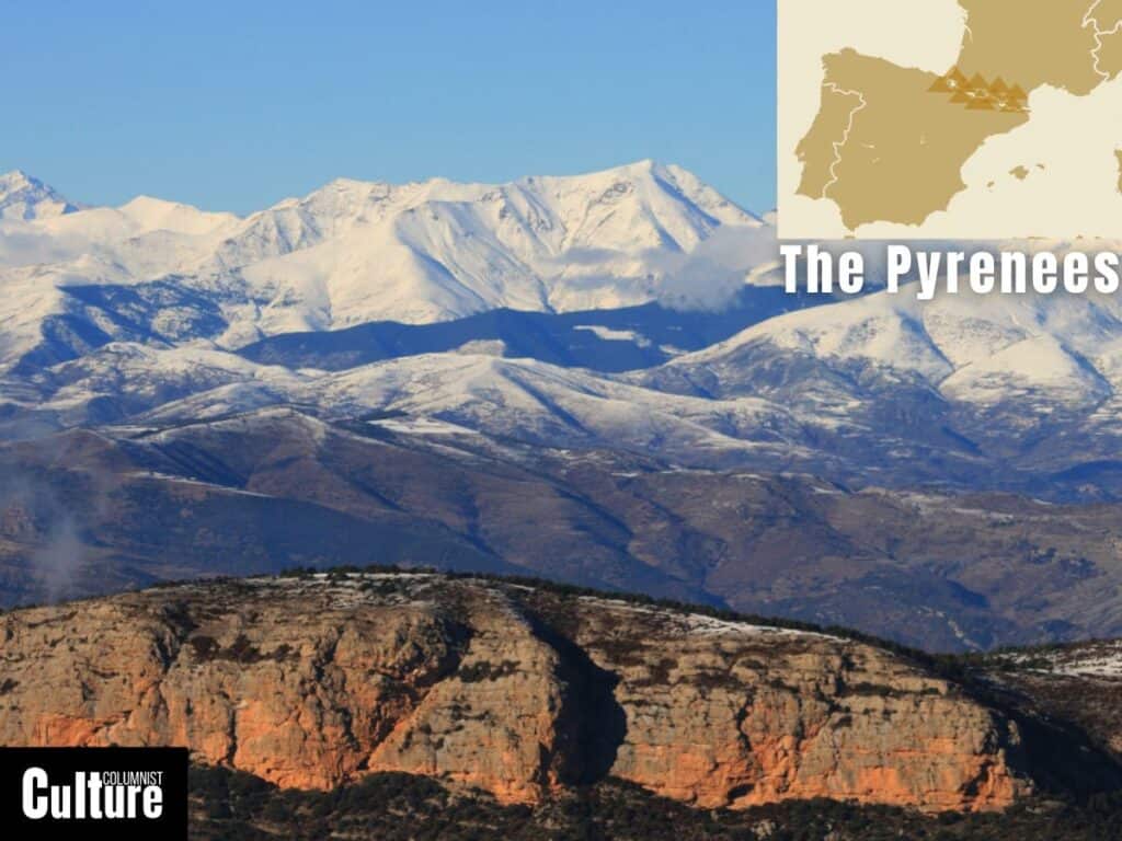
The Pyrenees are located in southwestern Europe and act as a natural border between the southwest of France and northern Spain. The mountains stretch from the Bay of Biscay in the west to the Mediterranean Sea in the east. The Pyrenees are best known for the Camino de Santiago pilgrimage route and for their ski resorts like Baqueira-Beret.
The range is approximately 430 kilometers long from coast to coast, boasting 129 main peaks and 83 secondary peaks, with Aneto being the highest, standing at 3,404 meters (11,168 feet). The range is home to the Pyrenees National Park, the UNESCO World Heritage Sites of Mont Perdu and the Niaux Cave and distinctive landscapes such as Ordesa Valley, the Gavarnie gorge and the glacial Lake Gaube.
The range is dotted with towns and villages that are steeped in history, such as Lourdes and Boí, with sites like the Fortress of Mont-Louis, the Château de Foix and the Romanesque Churches of Vall de Boí being among the most prominent attractions. These towns also serve as popular starting points for hiking trails that crisscross through the scenic landscapes.
The region boasts three long-distance trails for the intrepid explorer: the GR10 across the French Pyrenees, the GR11 along the Spanish side, and the HRP (Pyrenean Haute Route) that follows the highest points of the range, crisscrossing the Franco-Spanish border. There are also an array of shorter hiking routes, ideal for a few hours or a few days.
The Balkans
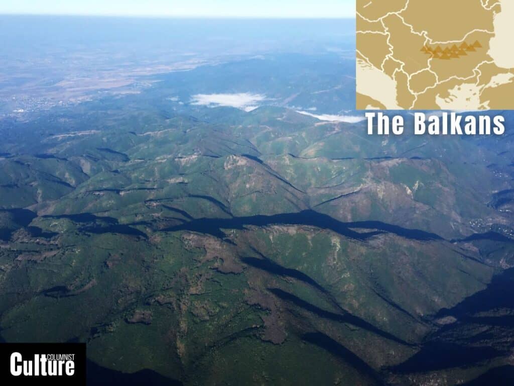
The Balkan Mountain range, also known as Stara Planina or the “Old Mountain,” stretches across Bulgaria and a small part of eastern Serbia. The range is known for its historic and UNESCO World Heritage Sites such as the Thracian Tomb of Kazanlak, the Magura Cave, which contains prehistoric cave paintings that date back to 8000 BCE, and the Madara Rider rock carving.
The mountains extend around 560 kilometers, with Botev being the tallest peak, reaching a height of 2,376 meters (7,795 feet). Nestled within the mountain range are distinctive features, from the meandering turns of the Iskar River, which has carved its gorge through the range, to the iconic Belogradchik Rocks, known for their unique red-hued rock formations.
Historic towns such as Gabrovo, known for its rich cultural and architectural heritage, and Veliko Tarnovo, often referred to as the “City of Tsars,” serve as starting points to explore the range. Between the towns of Gabrovo and Kazanlak, you’ll find the Shipka Pass, an important site where the Russian and Ottoman Empires came head-to-head in four fierce battles over Bulgaria’s independence.
Aside from a wealth of history, the mountains are home to hiking trails like the Kom-Emine, which runs the length of the range; the Central Balkan National Park, which preserves the local wildlife; and many ancient monasteries that you can venture to, such as the Troyan and the Glozhene Monastery.
The Apennines
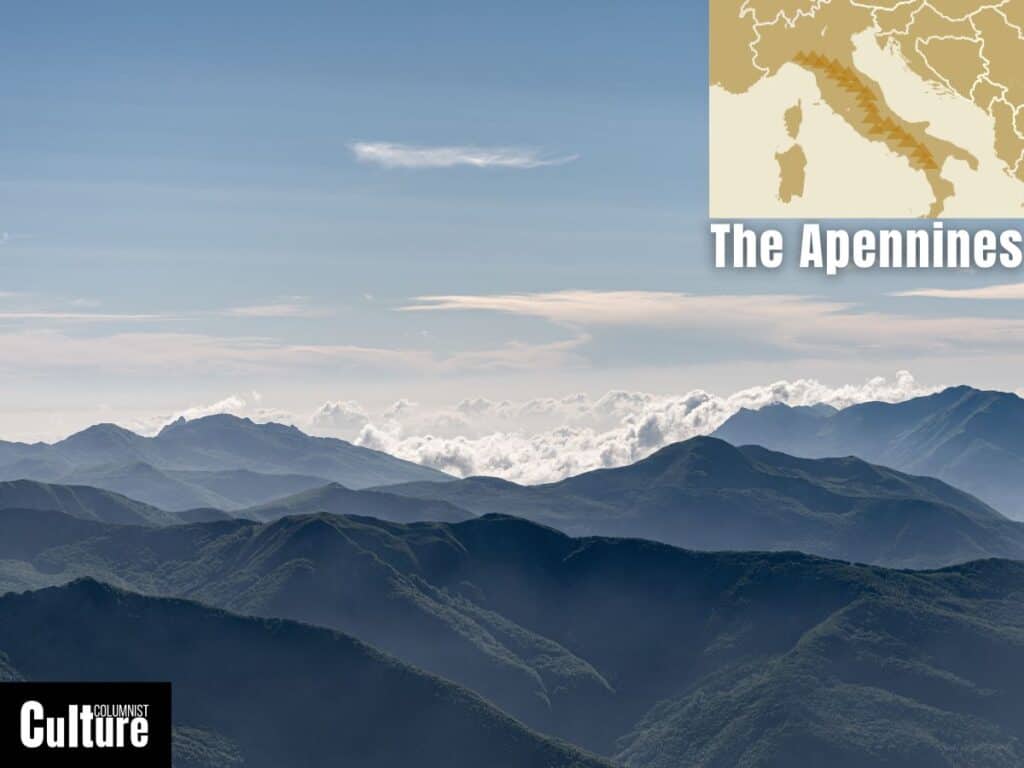
The Apennines, often called the “backbone of Italy,” is a mountain range that meanders through the centre of the Italian Peninsula, from Liguria to the southern tip of Calabria and into Sicily. Stretching across various latitudes and rising through several altitude zones, the Apennines offer different climates and ecosystems, from temperate forests in the north to the warmer Mediterranean scrublands in the south.
The Apennines stretch approximately 1,200 kilometers, with Corno Grande in the Gran Sasso massif being the most prominent peak, rising to an altitude of 2,912 meters (9,554 feet). Within this range lie hidden jewels like the Sibillini Mountains, characterized by their limestone formations, and the serene Orecchiella Park, home to diverse flora and fauna.
Historic towns like Assisi, with its Basilica of San Francesco, and L’Aquila, with its medieval structures, pepper the foothills and valleys of the range. Different sections of the range have their own distinct characteristics, such as the rugged, steep terrain in the Abruzzo Apennines and the less precipitous, rolling hills in the Tuscan-Emilian Apennines.
Hiking trails like the “Path of the Gods” are popular for their panoramic coastal views, while in winter, ski resorts such as Roccaraso attract sports enthusiasts. The range is also home to a system of 900 caves, some of which are open to visitors, such as Spipola (Gessi Bolognesi), Tanaccia and King Tiberius (Vena del Gesso Romagnola) and Onferno.
The Sierra Nevada
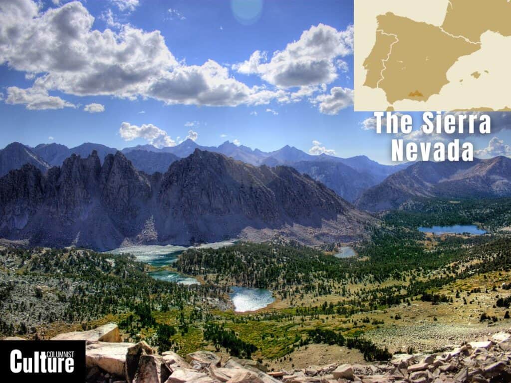
The Sierra Nevada is a mountain range located in southern Spain, within the region of Andalucía. Within this expansive range lie the Alpujarras valleys, white-wash villages and the Sierra Nevada National Park. The park is a UNESCO Biosphere Reserve with diverse ecosystems and glacial lakes, although the glaciers themselves have been retreating in recent years due to climate change.
Spanning roughly 320 kilometers (200 miles), the Spanish Sierra Nevada serves as a towering presence in the Iberian Peninsula, with its dramatic peaks. The range boasts the highest point in continental Spain, Mulhacén, which reaches an elevation of 3,479 meters (11,414 feet), dominating the landscape.
The area has been influenced by various civilizations, including the Moors, leaving a legacy of architectural wonders such as the Alhambra in nearby Granada. The mountain villages, or “Alpujarras,” are known for their unique Berber architecture, crafts, and local agricultural products like jamón serrano (cured ham) and olive oil.
In the winter, it becomes a prime destination for skiing and snowboarding, with the renowned resort of Pradollano offering snowy slopes and vibrant nightlife. When the snow melts, the mountains become a haven for hikers and cyclists, with trails such as the Sulayr long-distance path offering panoramic vistas and the opportunity to explore the diverse flora and fauna.
The Scandinavian Mountains
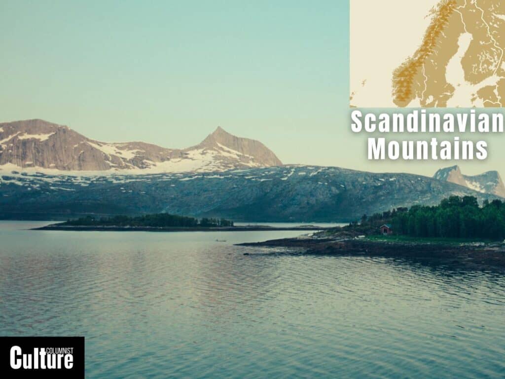
The Scandinavian Mountains, also known as the Scandes, are a mountain range that arcs through Norway and Sweden, with some extensions into northern Finland. The terrain is characterized by defined peaks, high plateaus, deep fjords and narrow inlets with steep sides, particularly on the Norwegian side.
Stretching for about 1,700 kilometers, the range is one of the longest in Europe, with Galdhøpiggen standing out as the highest peak, at an elevation of 2,469 meters (8,100 feet). The range’s standout features are the dramatic fjords of Geirangerfjord, ancient glaciers like Jostedalsbreen, and vast plateaus such as Hardangervidda, Europe’s largest mountain plateau.
While the highest peaks are found in the central and southern parts of Norway, the range also extends into the Lapland territories, where you can meet the indigenous Sami communities. Historic towns dot the range, such as Ålesund with its distinctive Art Nouveau architecture and Røros, a preserved mining town recognized as a UNESCO World Heritage Site.
In winter, the slopes of resorts like Åre come alive with snow sports, while the lack of light pollution makes it one of the best places to spot the Aurora Borealis Northern Lights. In summer, trails become accessible for hikers and trekkers, like the Kungsleden or “King’s Trail,” where you can make full use of the long days and trek to your heart’s content in the land of the Midnight Sun.
The Dinaric Alps
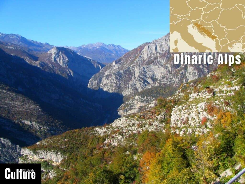
The Dinaric Alps are located in central Europe, stretching across the northwest of Italy, Slovenia, Croatia, Bosnia and Herzegovina, Montenegro, and into Albania. The Dinarides act as a rugged backbone to the Adriatic coast and are home to significant natural reserves such as Sutjeska National Park.
The Dinaric Alps stretch for about 645 kilometers, with Maja Jezercë in Albania being the range’s highest peak, reaching an impressive altitude of 2,694 meters (8,839 feet). The range’s most notable features include the Plitvice Lakes, a series of cascading lakes and waterfalls in Croatia, the Tara River Canyon in Montenegro, one of the deepest river canyons in Europe; and Lake Skadar, the largest lake in Southern Europe, shared by Montenegro and Albania
Historic cities and settlements are nestled within the range, like Dubrovnik, with its iconic fortified walls hugging the Adriatic Sea, and Mostar, famed for its Ottoman-era Stari Most bridge. These places are rich in historical sites, including medieval castles and churches, and are famous for traditional crafts like rug weaving and wood carving.
Adventure seekers are drawn to the Via Dinarica hiking trail, which connects the many national parks and cultural landmarks across the range, while the winter months transform parts of the mountains into skiing destinations like Bjelašnica in Bosnia and Herzegovina.
The Ural Mountains
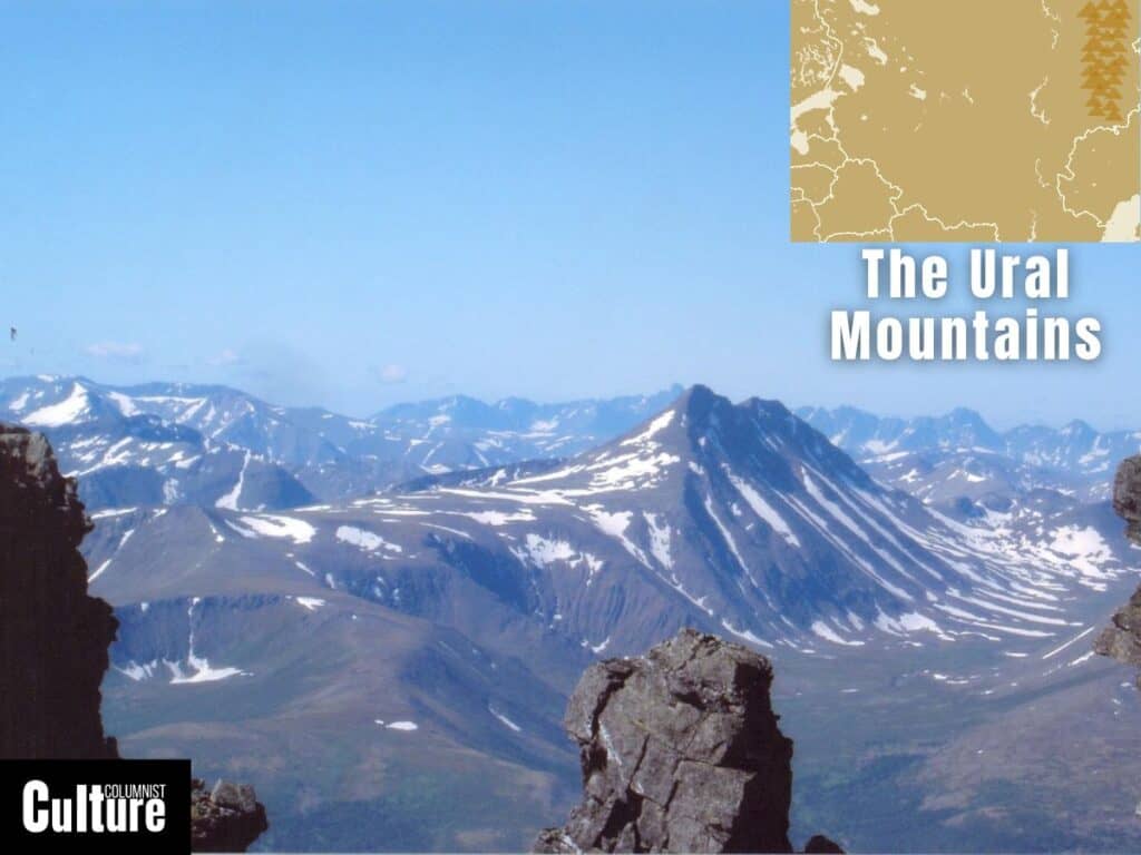
The Ural Mountains, often viewed as the natural boundary between Europe and Asia, stretch north to south through western Russia, from the Arctic Ocean to the northern edges of Kazakhstan. The Urals are among the world’s oldest mountain ranges, formed around 250 to 300 million years ago
The Ural mountains span approximately 2,500 kilometers (1,553 miles), with Mount Narodnaya as the most prominent peak, reaching an altitude of 1,895 meters (6,217 feet). These ancient mountains, though not the tallest, have been pivotal in shaping the nation we have today and are home to dense taiga forests and valuable mineral resources, making them a significant hub for mining.
Historic settlements like Yekaterinburg, a city that has witnessed pivotal events such as the execution of the last Russian Tsar and his family, and Perm, known for its cultural and theatrical prominence, are scattered along the Ural Mountains.
Dense forests offer many trails to explore, especially in Taganay National Park, while winter transforms parts of the region into skiing and snowboarding havens, with resorts like Mount Belaya as popular destinations. Furthermore, the Urals are home to unique geological formations such as the Manpupuner rock pillars that make for interesting travel photography.
The Caucasus
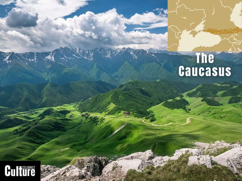
The Caucasus Mountains are a dramatic and imposing series of ranges that serve as the natural border between Eastern Europe and Western Asia, stretching between the Black Sea and the Caspian Sea and traversing several countries, including Russia, Georgia, Azerbaijan, and Armenia.
The Caucasus stretch approximately 1,200 kilometers (750 miles) from the northwest to the southeast. Mount Elbrus stands as the highest peak at 5,642 meters (18,510 feet) above sea level. The Caucasus Mountains are noted for their extensive alpine meadows, dense forests, extensive glaciers, deep canyons, high-altitude lakes, and mineral springs.
The region is rich in historical sites, such as the ancient city of Derbent, Mtskheta in Georgia and the Walled City of Baku, all recognised by UNESCO for their cultural and historical significance. The Vardzia cave monastery in Georgia and the medieval towers of Svaneti are also standout areas to explore in the range.
Popular sports and activities in the range include skiing at resorts like Rosa Khutor in Russia, trekking along routes such as the Transcaucasian Trail, and exploring national parks like the Borjomi-Kharagauli National Park in Georgia. However, one of the best activities in the Caucasus Mountains is getting to meet the over 50 ethnic groups of the region.
What is the most famous mountain range in Europe?
The Alps are the most famous mountain range in Europe, stretching approximately 1,200 kilometers across eight Alpine countries—France, Switzerland, Italy, Monaco, Liechtenstein, Austria, Germany, and Slovenia. The Alps are renowned for their stunning scenery, snow-capped peaks, beautiful nature and diverse activities.
The range gets its fame primarily from it’s well known mountains, such as Mont Blanc, the Matterhorn and Jungfrau, some of the most-visited mountains in Europe. They are a major destination for outdoor sports, particularly skiing, snowboarding, hiking, and mountaineering.
What are the wooded mountains in Europe?
The Black Forest, known in German as the Schwarzwald, is a prominent wooded mountain range located in southwestern Germany. It is one of the most well-known forested mountain ranges in Europe, characterized by its dense evergreen forests and picturesque landscapes.
As a mountainous region, the Black Forest features several peaks, with the Feldberg being the highest at 1,493 meters (4,898 feet). The forest covers an area of approximately 6,000 square kilometers, stretching from the town of Baden-Baden in the north to the Swiss border in the south. It has a thick canopy of primarily fir and pine trees, which give the forest its name due to the dark appearance of the tree cover when viewed from a distance.
The Black Forest is not just a natural wonder but also exemplifies the unique and vital role of forests in Europe. It is famously associated with the Brothers Grimm fairy tales and is often depicted as a mystical and enchanting land in literature and art.