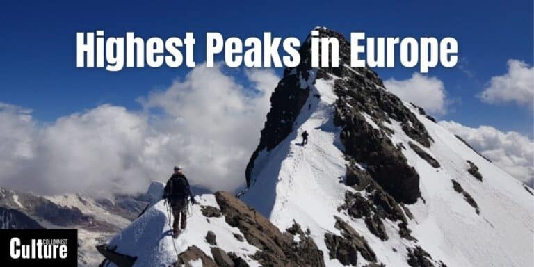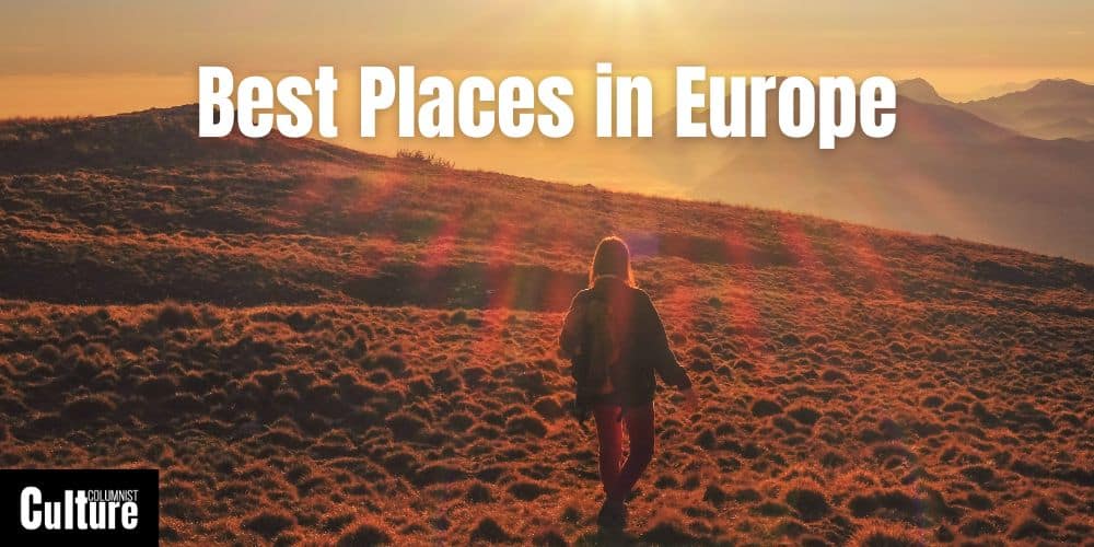
Best Places & Landscapes To Visit In Europe
Europe offers a diverse range of scenic places that captivate travelers worldwide.
From the rugged cliffs of Ireland’s Wild Atlantic Way to the idyllic lavender fields of Provence, these natural settings offer more than just photogenic scenes; they offer experiences that enrich the soul.
With such an array of landscapes to explore, the challenge often lies in deciding which ones will make it to your travel bucket list.
Are you in search of an adventure-filled escapade in the mountains or more interested in a tranquil seaside retreat?
Some destinations are best for hiking and camping, while others offer perfect settings for kayaking, photography, or even some much needed solitude.
European landscapes have their own characteristics, climates and features to take into consideration, but no matter your phase in life—be it a young explorer, a family with kids, or a retiree—they have something to offer everyone.
Below is a curated list of the most awe-inspiring places in Europe that you won’t want to miss.
These places do more than just please the eye; they educate and inspire, connecting travelers to the rich heritage and diverse cultures that have shaped Europe over millennia.
This list is not just instagram-worthy, each place contributes something special to Europe’s unique landscape and offers a truly memorable experience that will make your trip unforgettable.
Whether you’re a nature enthusiast, an avid photographer, or simply someone looking to escape the daily grind, there’s a beautiful place in Europe for you to explore.
Table of Contents
The Alps
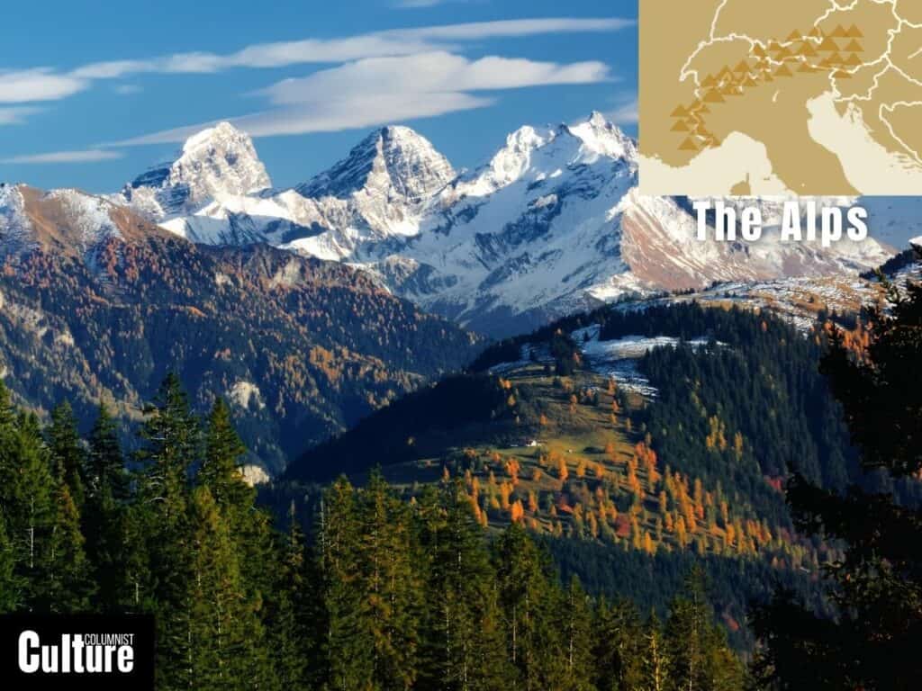
The Alps are a mountain range extending across eight European countries, including France, Italy, Switzerland, Austria, Germany, Monaco, Slovenia, and Liechtenstein.
Formed approximately 65 million years ago through the collision of the African and Eurasian tectonic plates, they are one of Europe’s most iconic landscapes.
The Alps have played a crucial role in European history, culture, and trade, serving as both a natural barrier and a link between different regions.
The Alps span around 1,200 kilometers, and are known for their high peaks, some of which exceed 4,000 meters, such as Mont Blanc and the Matterhorn, while deep valleys like the Rhône Valley in Switzerland offer contrasting landscapes.
Glaciers, such as the Aletsch Glacier, the largest in the Alps, are another significant feature.
The Arctic Tundra
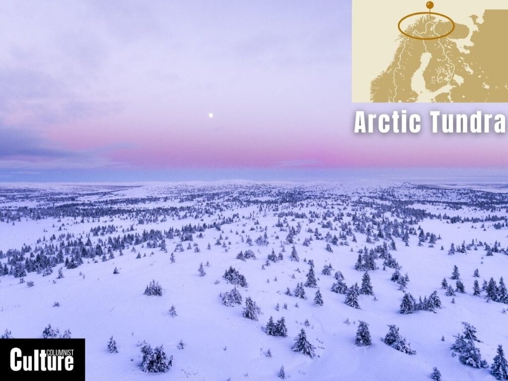
The Arctic Tundra is a biome that spans across multiple countries in the Northern Hemisphere, encompassing parts of Canada, Russia, Greenland, Scandinavia, and Alaska in the United States.
This landscape has short summers and long, harsh winters with a mean temperature below 0°C for six to 10 months of the year.
Formed over thousands of years through glacial activity and climatic shifts, the Tundra is crucial for studying the impacts of climate change.
The landscape is best known for its treeless plains and a ground that is often frozen solid.
Notably, the soil in the tundra is permafrost, a permanently frozen layer that can reach depths of up to 1,476 feet, resulting in a unique phenomenon of “polygons,” geometric shapes in the landscape caused by the freeze-thaw cycle of the permafrost.
The Ardennes
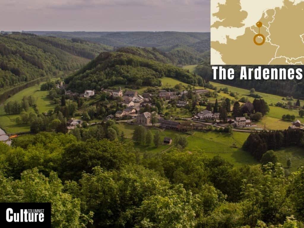
The Ardennes is a region of extensive forests, rolling hills, and ridges primarily located in Belgium and Luxembourg, with portions extending into France and Germany.
Formed around 300 to 400 million years ago, the mountain range is historically significant for its role in various military campaigns, including the Battle of the Bulge in World War II.
The landscape is composed of dense forests of oak, beech, and pine, deep valleys, meandering rivers, and high plateaus.
Notable features include the caves of Han-sur-Lesse in Belgium, formed by the river Lesse cutting through limestone, and the High Fens, a unique upland area featuring one of the oldest and most pristine peat bogs in Europe.
The Azores
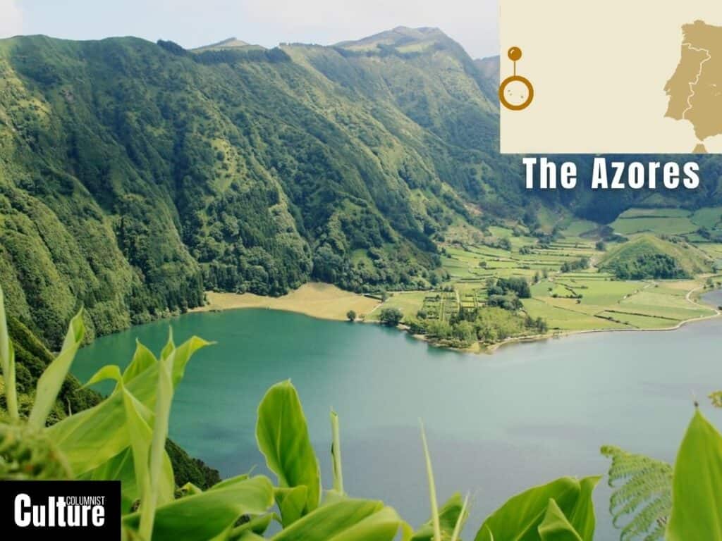
The Azores is an archipelago composed of nine volcanic islands situated in the North Atlantic Ocean, approximately 1,500 km from mainland Portugal.
The islands are an autonomous region of Portugal and are situated along the boundary between the North American and Eurasian tectonic plates.
They were formed by volcanic activity originating from the mantle plume, commonly known as the Azores hotspot.
The Azores offer a diverse array of natural landscapes, including stratovolcanoes, crater lakes, and lush vegetation.
Among its most notable features are the twin lakes of Sete Cidades on São Miguel Island, which consist of one blue and one green lake situated in a dormant volcanic crater.
Pico Island is home to Mount Pico, the highest peak in Portugal, rising 2,351 meters above sea level.
The islands are known for their unique Azorean Laurel Forests, geothermal springs and fumaroles, particularly in areas like Furnas on São Miguel Island.
Vatnajökull glacier
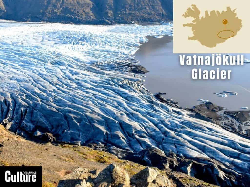
Vatnajökull is a prominent glacier located in southeastern Iceland, covering an area of about 7,900 square kilometers.
It is not only the largest glacier in Iceland but also the largest ice cap in Europe by volume.
The glacier resides within the Vatnajökull National Park, which is a UNESCO World Heritage site and was formed through the accumulation and compaction of snow over thousands of years.
Vatnajökull is known for its breathtaking features, including numerous outlet glaciers, dramatic ice caves, and vast ice plains.
The glacier lies atop several active volcanoes, including Grímsvötn and Bárðarbunga, whose eruptions have occasionally led to jökulhlaups or glacial floods.
Its subglacial lakes and volcanic activity beneath the ice create unique geological phenomena like calderas and ice cauldrons.
The Burren
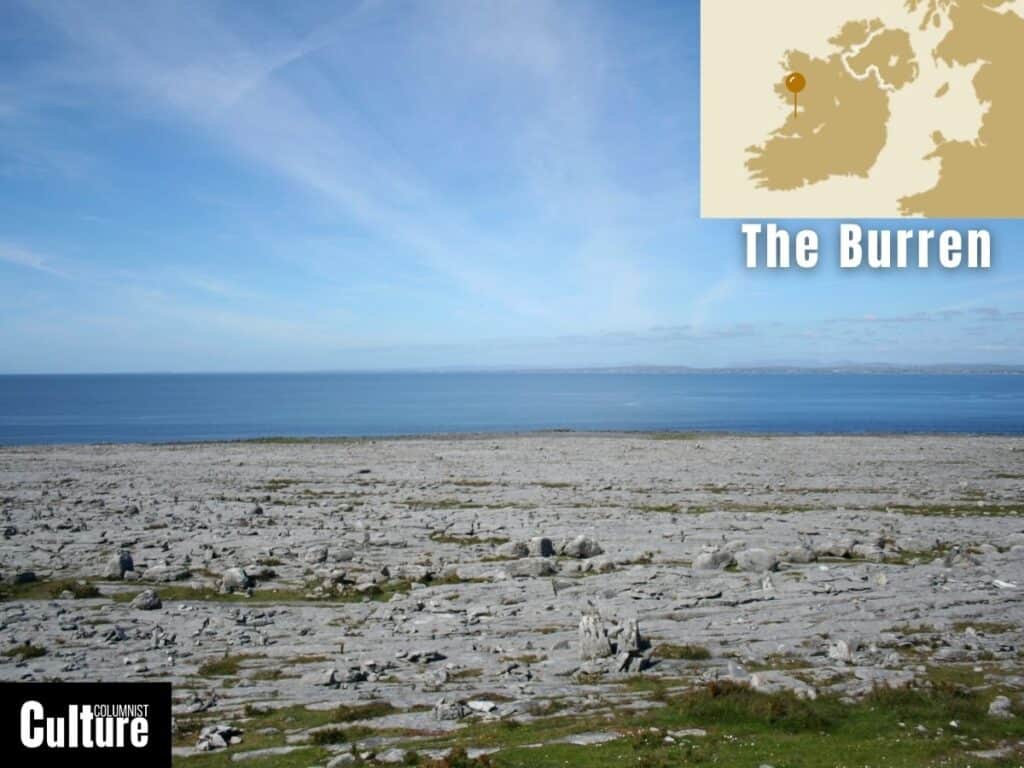
The Burren is a distinctive limestone karst landscape located in County Clare, in the west of Ireland. Covering approximately 250 square kilometers, the Burren is one of Europe’s most extensive karst regions.
Formed about 340 million years ago under a tropical sea, the area saw lots of shells and tiny sea plants and animals pile up on the seafloor, eventually turning into a type of rock called limestone.
The Burren, coming from the Irish term “Boíreann,” meaning “a rocky place,” is known for its barren, moon-like terrain comprising limestone pavements with crisscrossing cracks, known as “grikes,” and isolated rocks, known as “clints.”
Unique to the Burren are the “turloughs,” or seasonal lakes that disappear and reappear, while the landscape is also home to ancient dolmens, stone forts, and other archaeological features.
The Camargue
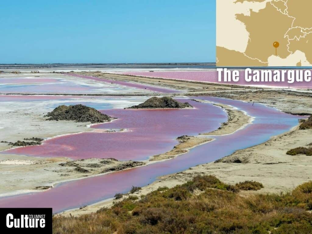
The Camargue, located in the south of France, is a river delta encompassing both wetlands and dry lands, spanning over 930 square kilometers.
It is Western Europe’s largest river delta and is significant for its unique ecosystems, which include salt marshes, lagoons, and reed-covered wetlands, contributing to the region’s role as a vital sanctuary for migratory birds as one of their last frontiers before reaching Africa.
The Camargue landscape includes vast salt flats, natural brine ponds, and dune-backed beaches.
The area is particularly known for its pink flamingos, white Camargue horses, and black bulls, which have adapted to the salty, marshy conditions.
Several unique species of aquatic plants, such as sea lavender, also thrive here. The region is a hotspot for birdwatching, housing over 400 species of birds, including the endangered slender-billed curlew and the Eurasian stone-curlew.
The Carpathian Mountains
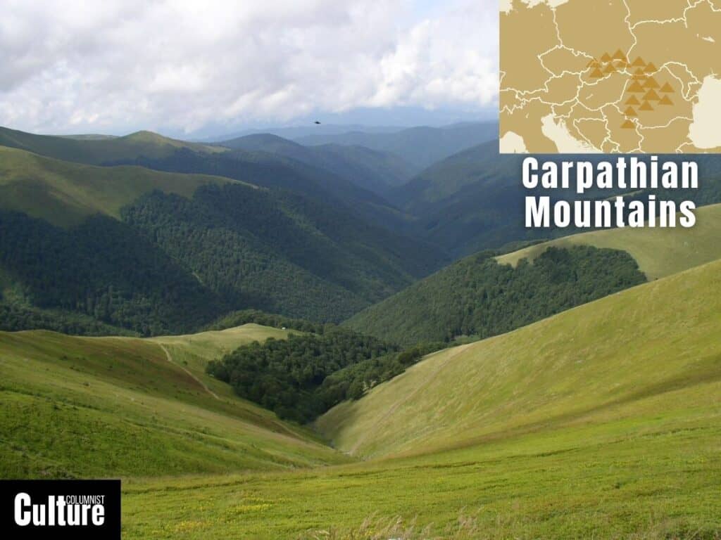
The Carpathian Mountains are a mountain range located in Central and Eastern Europe that extends across several countries, including Romania, Slovakia, Ukraine, Poland, the Czech Republic, and Serbia.
The range covers approximately 1,500 km and is the second-longest mountain range in Europe. The Carpathian Mountains are divided into three major parts: the Western Carpathians, the Eastern Carpathians, and the Southern Carpathians, each with distinct landscapes.
The range is characterized by a mix of rugged peaks, high-altitude plateaus, dense forests, and river valleys that serve as a paradise for outdoor and adventure enthusiasts.
The highest peak is Gerlachovský štít in Slovakia, rising to 2,655 meters. The region also hosts the largest virgin forests in Europe, primarily composed of beech trees, and offers a critical habitat for many species, including brown bears, wolves and lynxes.
The Cliffs of Dover
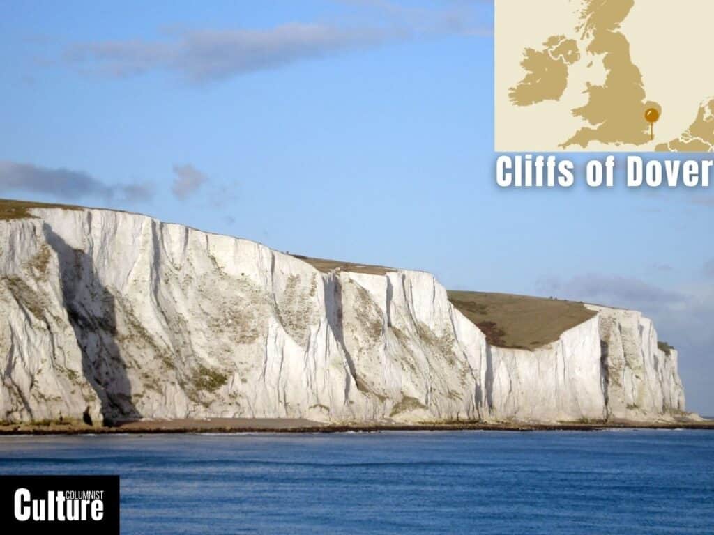
The Cliffs of Dover are iconic chalk cliffs located along the southeastern coastline of England, facing the English Channel.
They form part of the North Downs and extend from the towns of Dover and Deal in Kent. The cliffs are composed of pure white chalk as a result of the accumulation of marine microorganisms over millions of years.
The Cliffs of Dover hold a significant place in British history and identity, serving as a natural defense and symbol of resilience, particularly during World War II.
They are visually spectacular, rising as high as 350 feet (110 meters) and stretching for about 10 miles. Their bright white color is due to their high chalk content, making them instantly recognizable and a natural wonder.
The Cliffs of Moher
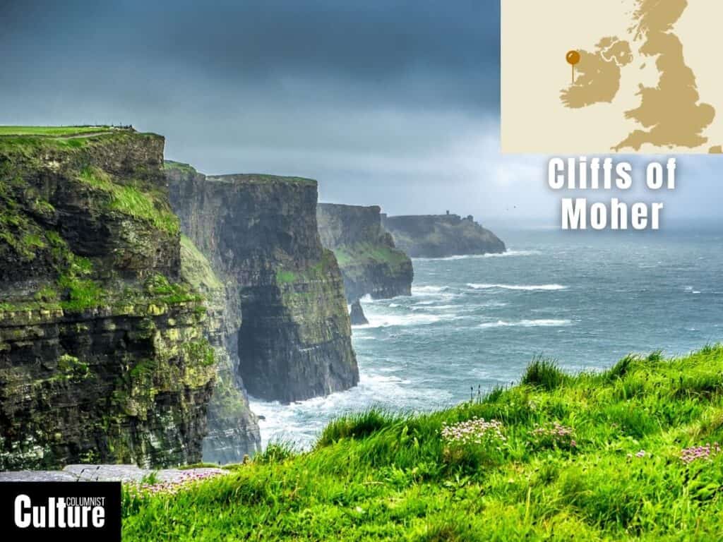
The Cliffs of Moher are located on the western coast of Ireland, in County Clare. Stretching for approximately 14 kilometers, these cliffs are primarily made up of Namurian shale and sandstone.
Rising dramatically from the Atlantic Ocean, the cliffs have long held a place in Irish folklore and serve as one of the most visited natural attractions in Ireland, making them a natural wonder.
The cliffs reach a maximum height of 214 meters (702 feet), offering breathtaking views of the Atlantic Ocean.
The layers of sedimentary rock showcase various shades of color, particularly when struck by the sun, making them even more visually striking.
The cliffs are home to one of the major colonies of cliff-nesting seabirds, including Atlantic puffins, guillemots, and razorbills, and are a designated UNESCO Global Geopark.
The Dalmatian Coast
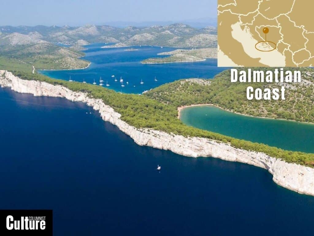
The Dalmatian Coast is located along the eastern coast of the Adriatic Sea, stretching from Zadar in the north to the Bay of Kotor in the south, primarily in Croatia but also extending into Montenegro.
The coast was formed from the dissolution of soluble rocks like limestone, dolomite, and gypsum and has been inhabited since ancient times, seeing the influence of various civilizations, including the Illyrians, Romans, and Venetians.
The coast is renowned for its rugged terrain, featuring coves, caves, and a scattering of over a thousand islands and islets.
The limestone cliffs and rocky outcrops are interspersed with pebble beaches and crystal-clear waters. This area is particularly rich in biodiversity, with pine and olive trees commonly found along the coast.
The Icelandic Lava Fields
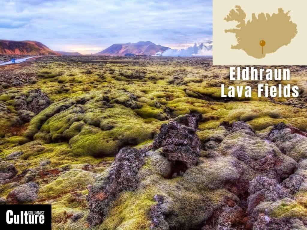
The Icelandic Lava Fields are volcanic landscapes located in the Southern Lowlands and the Icelandic Highlands, with some well-known examples being Eldhraun and Berserkjahraun.
These fields are the result of numerous volcanic eruptions from Iceland’s active volcanic systems, which are a part of the Mid-Atlantic Ridge and make it one of the most volcanically active landscapes in Europe.
The lava fields present a dramatic, often otherworldly terrain, featuring jagged rocks, basalt columns, and contorted lava flows that have solidified into various shapes and forms.
Over time, mosses and lichens begin to cover the lava, adding shades of green to the otherwise stark black and gray landscape.
One of the most distinctive features of these fields is the “rope lava,” twisted formations that occur as the lava cools and contracts.
Verdon Gorge
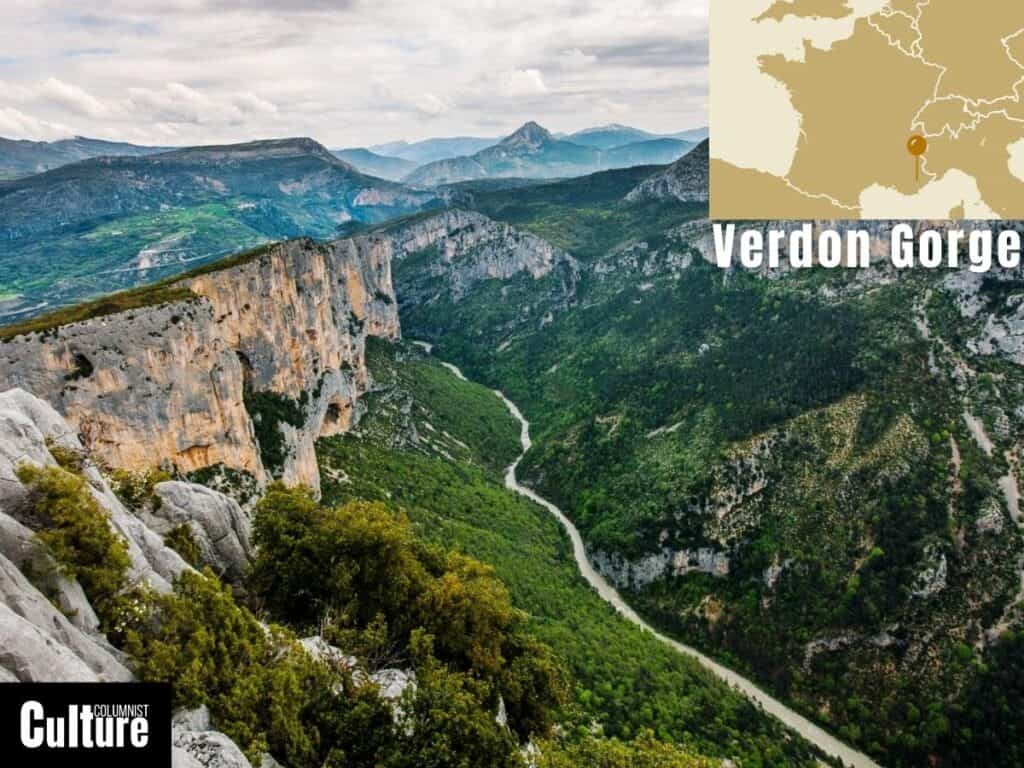
The Verdon Gorge is one of the largest river canyons in Europe, located in the Provence-Alpes-Côte d’Azur region of southeastern France.
It’s commonly referred to as the “Grand Canyon of Europe,” thanks to its dramatic landscape carved out of the rock by the Verdon River through erosion over millions of years.
One of the most striking features of the Verdon Gorge is its turquoise water, created by the rich mineral content in the limestone.
The steep rock formations that form the gorge can be as deep as 700 meters, creating dramatic cliffs on either side of the river and rewarding hikers with beautiful views down into the valley.
The landscape is dotted with caves, arches, and rock formations that make it a hotspot for rock climbers.
The Lavender Fields
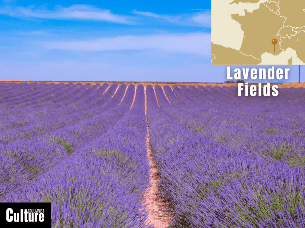
The Lavender Fields are situated in the Provence region of southeastern France, specifically Vaucluse and Alpes-de-Haute-Provence.
Historically, lavender has been cultivated in Provence for centuries and has played a significant part in France’s history of perfume making.
The Lavender Fields are a symbol of Provence and are celebrated throughout the region, featuring everything from museums to cosmetics, tea, perfume and distilleries.
The landscape is characterized by rolling fields of vibrant purple lavender stretching as far as the eye can see, typically bordered by traditional stone fences or rows of trees like cypress and olive.
The lavender species primarily grown is Lavandula angustifolia, known for its high-quality essential oil, which typically blooms from late June to August, depending on the weather.
The Lofoten Islands
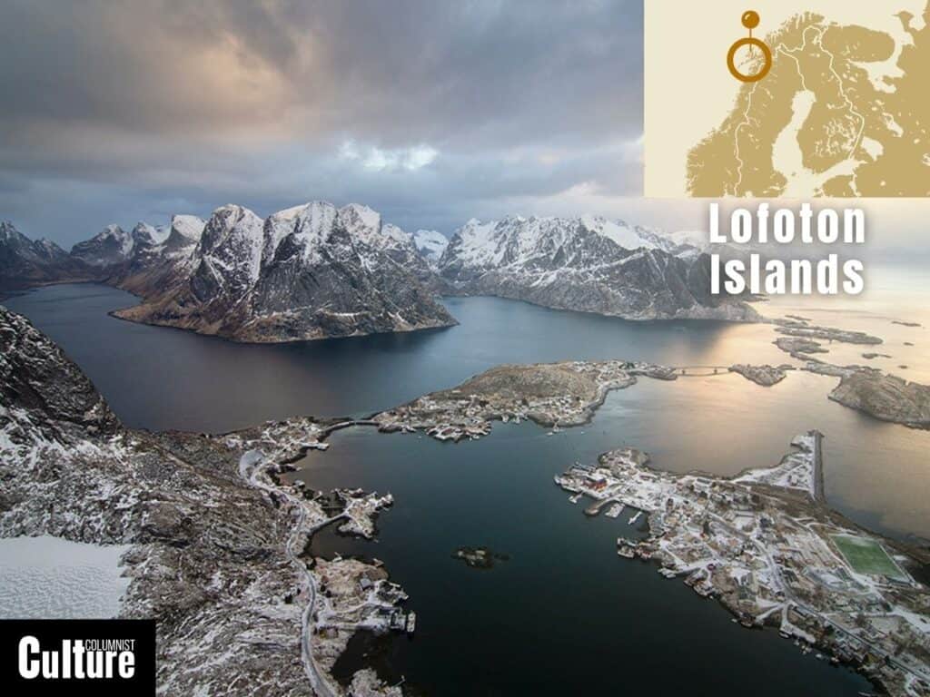
The Lofoten Islands are an archipelago located above the Arctic Circle in Nordland County, Norway.
The islands were formed through volcanic activity about 500 million years ago and have a distinct topography that is uncommon, with 160 km of wild and craggy mountains that rise directly from the sea.
The islands are home to many idyllic fishing villages with red cabins built on stilts above the water.
The landscape of the Lofoten Islands is characterized by towering mountain peaks, deep fjords, and sandy beaches.
The islands have an unusual climate for their location: despite being in the Arctic, they enjoy relatively mild winters due to the Gulf Stream.
Jagged granite mountain formations are a prominent feature, along with sheltered bays home to a diverse range of arctic birds like King Eider, white-billed divers and purple sandpipers.
Dune Du Pilat
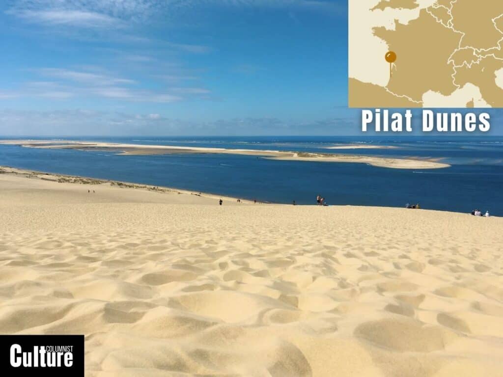
The Dune du Pilat, also known as the Great Dune of Pyla, is situated in La Teste-de-Buch, in the Arcachon Bay area of southwestern France.
It is the tallest sand dune in Europe, and its formation is attributed to the accumulation of sand from the Atlantic Ocean, shaped by wind patterns over thousands of years.
The dune has served as a natural marvel for tourists, photographers, nature lovers and adventure seekers alike.
At its highest point, the sand dune rises up to 110 meters, spans 500 meters in width, and stretches for nearly 3 kilometers (1.8 miles) along the coastline.
Its sheer scale dominates the landscape, standing out distinctly from the backdrop of the ocean and forest.
To the naked eye, the dune appears static but is actually in constant flux, moving inland at a rate of up to 5 meters per year towards the adjacent pine forest.
The Mediterranean Coast
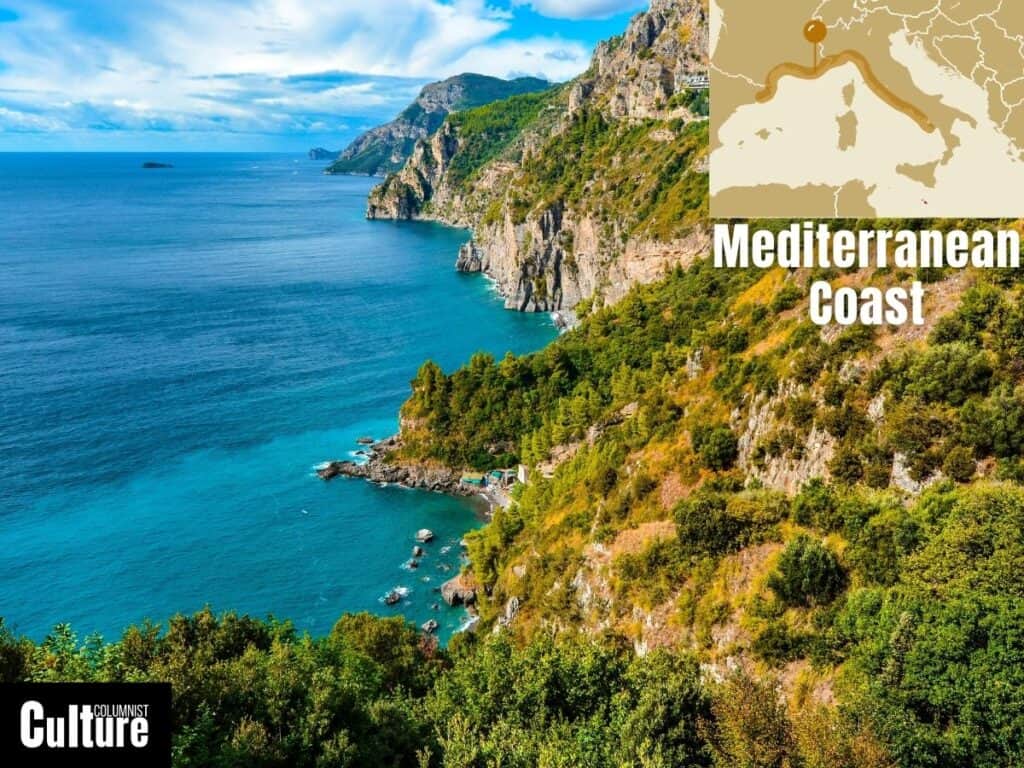
The Mediterranean Coast spans multiple countries, including France, Spain, Italy, Greece, and Turkey, among others.
The rugged landscape is adjacent to the Mediterranean Sea, and has been the site of numerous ancient civilizations.
From the Roman ruins in Italy to the ancient Greek temples in Athens, the landscape is dotted with UNESCO world heritage sites ready to explore.
The Mediterranean Coast is composed of a wealth of different terrains, including sandy beaches, azure waters, rocky cliffs, and lush vegetation.
The region’s climate—characterized by hot, dry summers and mild, wet winters—is perfect for early birds who love the sunrise or night owls who prefer sunset cocktails.
From the glamorous shores of the French Riviera to the untouched beauty of Greece’s islands, the Mediterranean coast is a landscape that rarely disappoints.
The Meteora
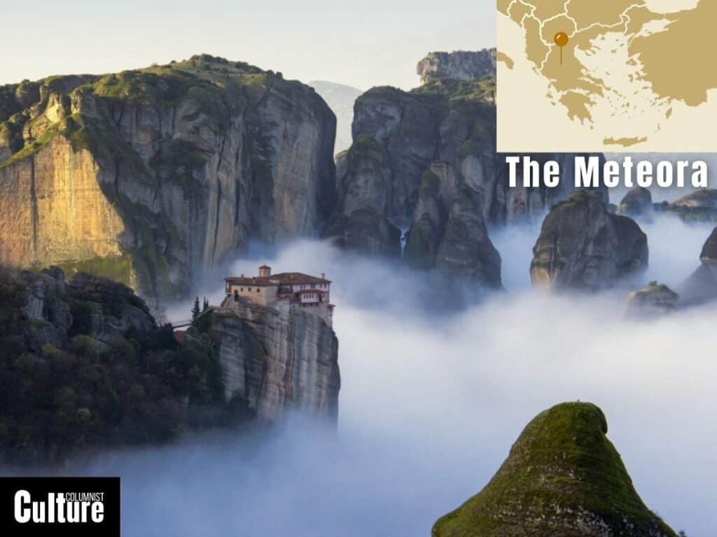
Meteora is a landscape located in central Greece, near the town of Kalabaka and the mountains of Pindos.
It is renowned for its monolithic pillars and Orthodox monasteries perched precariously on top of dramatic rock formations.
Formed over 60 million years ago through a series of earthquakes and errosion, the inaccessible rock formations served as a sanctuary and refuge for Orthodox monks from the threat of Turkish occupation.
The outstanding sandstone rock pillars rise up to 400 meters in height, creating a truly surreal landscape that has earned its status as a UNESCO World Heritage Site.
It’s the perfect landscape for adventure and adrenaline seekers, offering plenty of ways to take in the scenery, whether it’s through rock climbing, hiking, paragliding or even base jumping for the truly daring.
The Norwegian Fjords
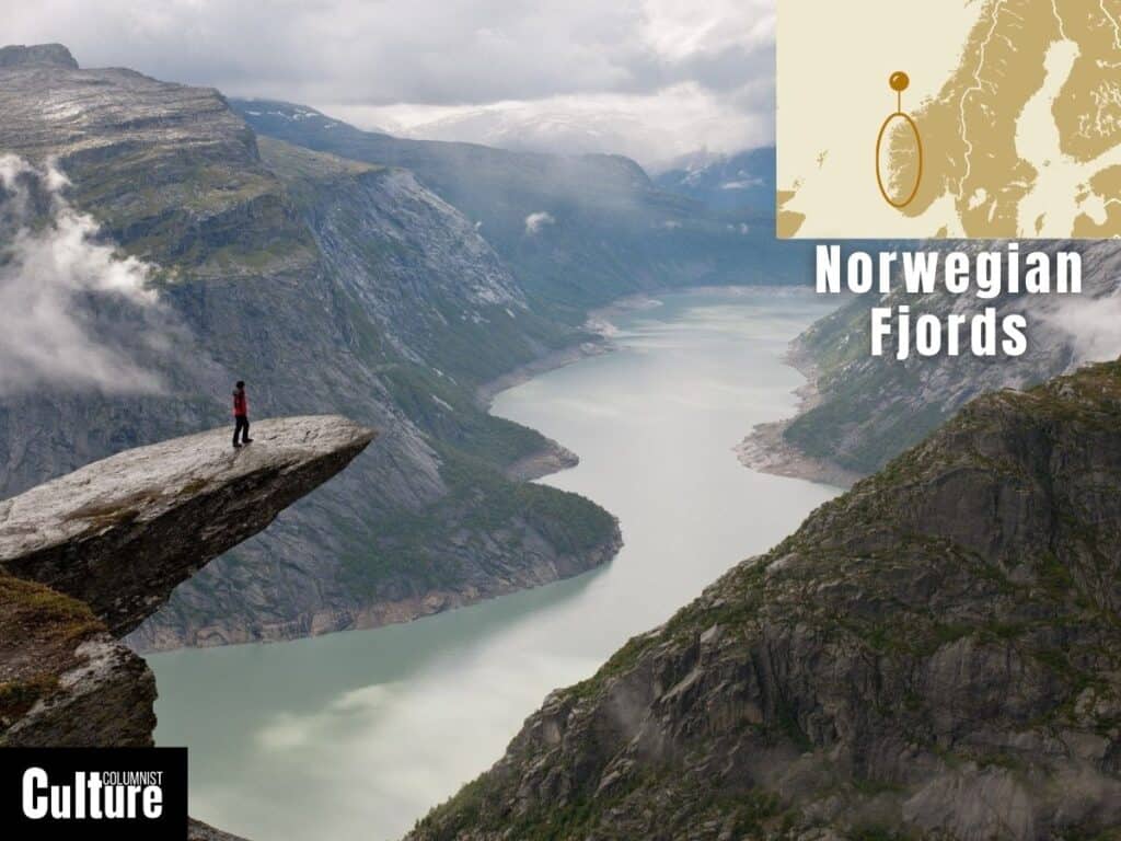
The Norwegian Fjords are a series of deep, narrow inlets found along the western coast of Norway, stretching from the southern tip of the country up to the Arctic Circle.
They were formed over the course of millions of years through glacial activity, including repeated periods of glaciation and melting.
The fjords feature steep, towering cliffs that plunge into deep waters, sometimes reaching depths of over 1,300 meters.
Glacial characteristics like hanging valleys and powerful waterfalls add to the dramatic scenery, helping the Norwegian Fjords earn their title as a UNESCO World Heritage site and natural wonder that should be seriously considered on every European travel itinerary.
The Puszta
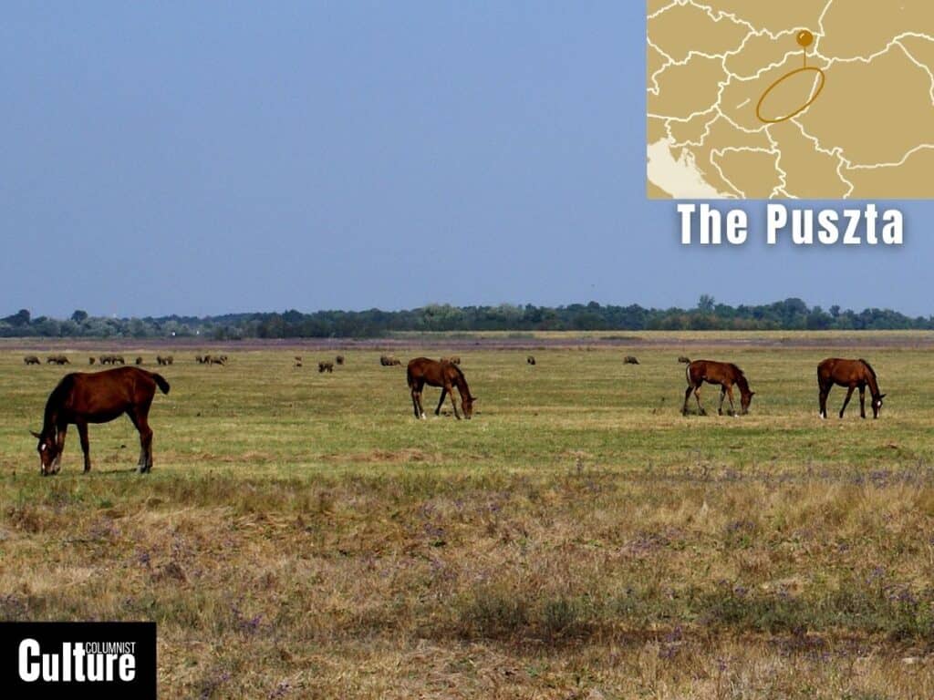
The Puszta is a vast flat grassland located primarily in Hungary, extending into parts of Serbia, Slovakia, Romania, and Austria.
It’s notably represented in the Hortobágy National Park, Hungary’s first national park, which is also a UNESCO World Heritage Site.
The Puszta has been shaped by both natural events and pastoral farming for thousands of years.
The Puszta is characterized by its flat terrain, which is occasionally broken by shallow lakes and wetlands, which help to support the landscape’s diverse wildlife.
It hosts unique species such as the Great Bustard, the Red-footed Falcon and the Hungarian meadow viper, while wild horses are free to roam the plains.
Consider an organised horse show, a nature tour, or a guided equestrian tour to immerse yourself in the landscape and explore Hungary’s less touristy areas.
The Scottish Highlands
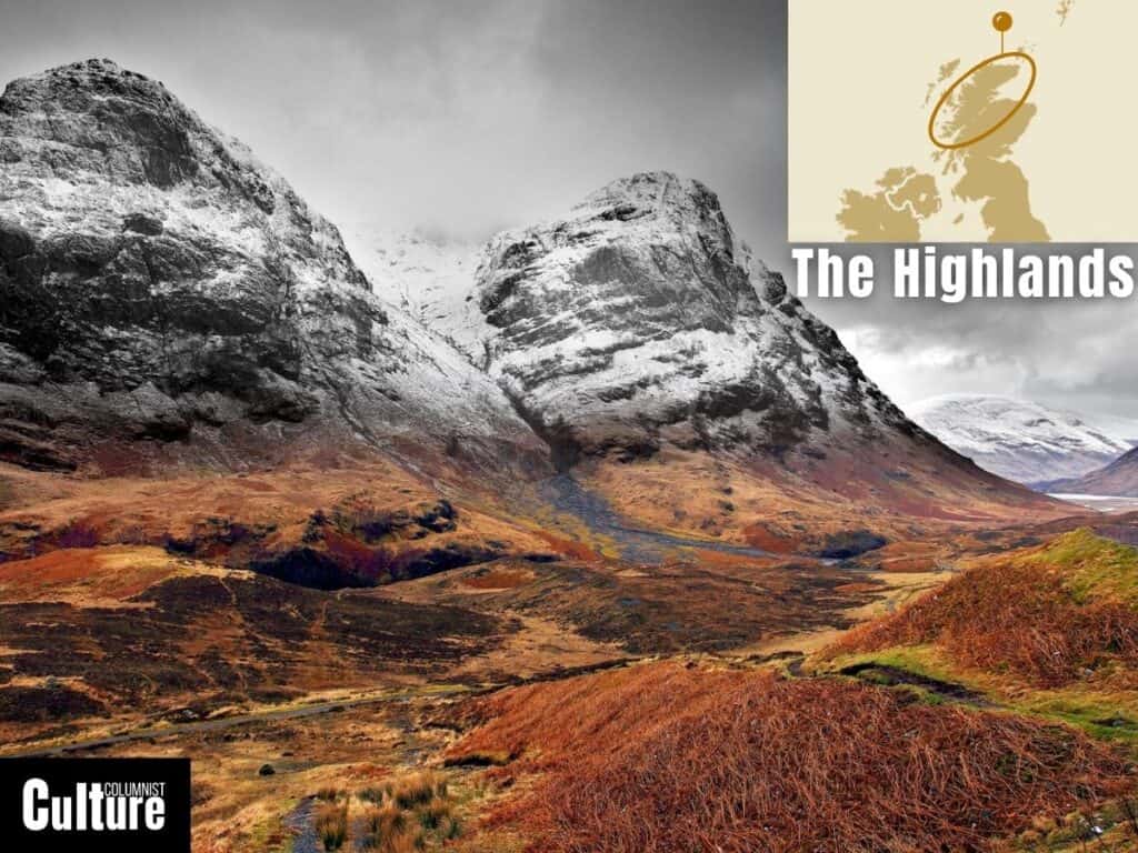
The Scottish Highlands are a mountainous region located in northern Scotland, covering approximately 25,656 square miles.
The landscape has been shaped over millions of years by glacial activity during the last Ice Age and the collision of ancient continents.
The Highlands provide the setting for many battles and uprisings against the British, including the Jacobite uprisings.
The Highlands are marked by rugged mountains, deep glens (valleys), and expansive lochs (lakes).
Ben Nevis, the highest peak in the British Isles, is a notable landmark, while Loch Ness is most famous for the legendary Loch Ness Monster, also known as “Nessie.”
This mythical creature is said to inhabit the deep, murky waters of Loch Ness, making the area popular for hiking, boating, and other outdoor activities.
The Spanish Deserts
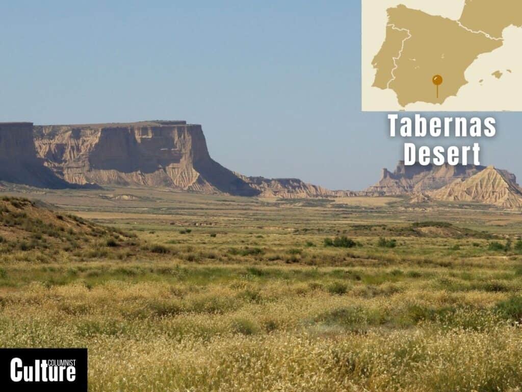
The Spanish Deserts, notably the Tabernas Desert, are located in southeastern Spain in the province of Almería, Andalusia.
The desert doesn’t get much rain, but when it does, it pours really hard and fast, creating temporary rivers that carve out ditches and grooves in the soft ground, making the landscape look like it has deep channels and pointy ridges.
The desert landscape has been used as a setting in iconic films and Westerns such as Once Upon a Time in the West, Indiana Jones and Lawrence of Arabia.
The desert is home to around 14 constructed western style villages made for filmmaking, some of which are still used today.
Hiking is one of the best ways to see the desert, with the most popular hiking trail being the Sendero del Desierto, a 9-14 kilometre (6-9 mile) trail that crosses the landscape’s most iconic features.
The Tuscan Countryside
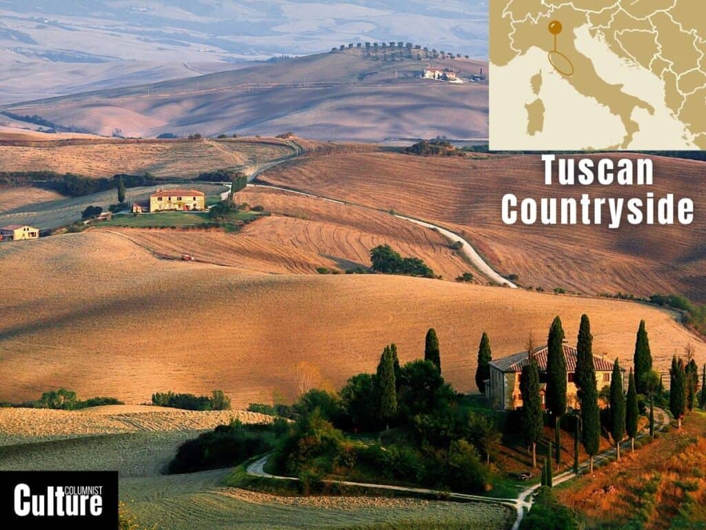
The Tuscan Countryside is located in central Italy. This landscape is renowned for its rolling hills and valleys that inspired countless Renaissance artists and features a mosaic of fertile valleys and traditional farmlands with tall Cypress trees lining the roads.
The “balze,” a unique rock formation shaped by erosion, also marks the landscape with more dramatic scenery.
The landscape consists of a diverse range of soil types that allow the region to produce many varieties of grapes and olives.
The Chianti Hills, Val d’Orcia, and the Crete Senesi are some of its most iconic areas. Olive groves and vineyards are abundant, and the region is famous for its wine production, especially Chianti, Brunello di Montalcino, and Vino Nobile di Montepulciano.
The Vineyard Terraces
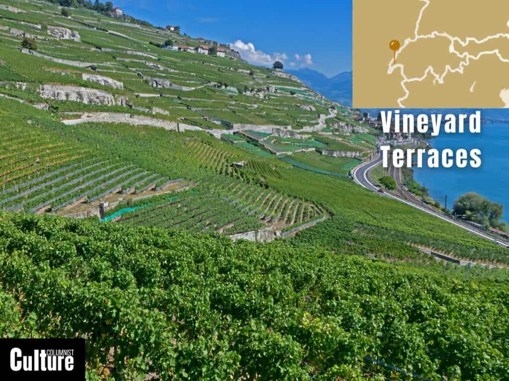
The Lavaux Vineyard Terraces are a beautiful stretch of vineyards along the north side of Lake Geneva in Switzerland’s Vaud region.
These terraced vineyards have been around since the 11th century, thanks to the monks who started the winemaking in the area.
Recognized by UNESCO as a World Heritage Site, the terraces stretch for about 30 km along the lake, with vineyards divided by stone walls, creating a visually striking geometric pattern on the landscape.
The terraces offer panoramic views of Lake Geneva and the surrounding Alps, with plenty of walking routes open to tourists to explore the area.
The area’s microclimate makes it an ideal location for grape-growing, specifically for the production of Chasselas, a famous white Swiss wine grape.
The steep terraced structure also contributes to water drainage and soil fertility, making it the perfect place to grow grapes and taste a glass or two.
El Tocal Rock Formations
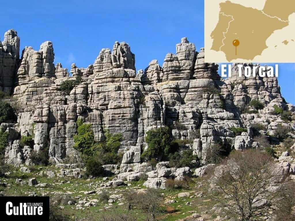
El Torcal de Antequera is a natural reserve located in the Sierra del Torcal mountain range, in the province of Málaga, Spain.
The landscape is renowned for its striking limestone rock formations, which were formed around 150 million years ago during the Jurassic period.
Tectonic forces pushed it up, and the combination of rain and low temperatures further shaped the rocks, making it feel like stepping back in time.
The landscape features a host of naturally sculpted shapes, including towers, spires, balanced boulders, deep ravines and even caves.
Numerous caves and underground formations in El Torcal have evidence of ancient human occupation. So it’s not just a natural wonder but also a historical site.
The landscape also has various trekking routes where you can navigate a labyrinth of rocks, spot mountain goats, and admire the rock formations up close.